Identification Survey
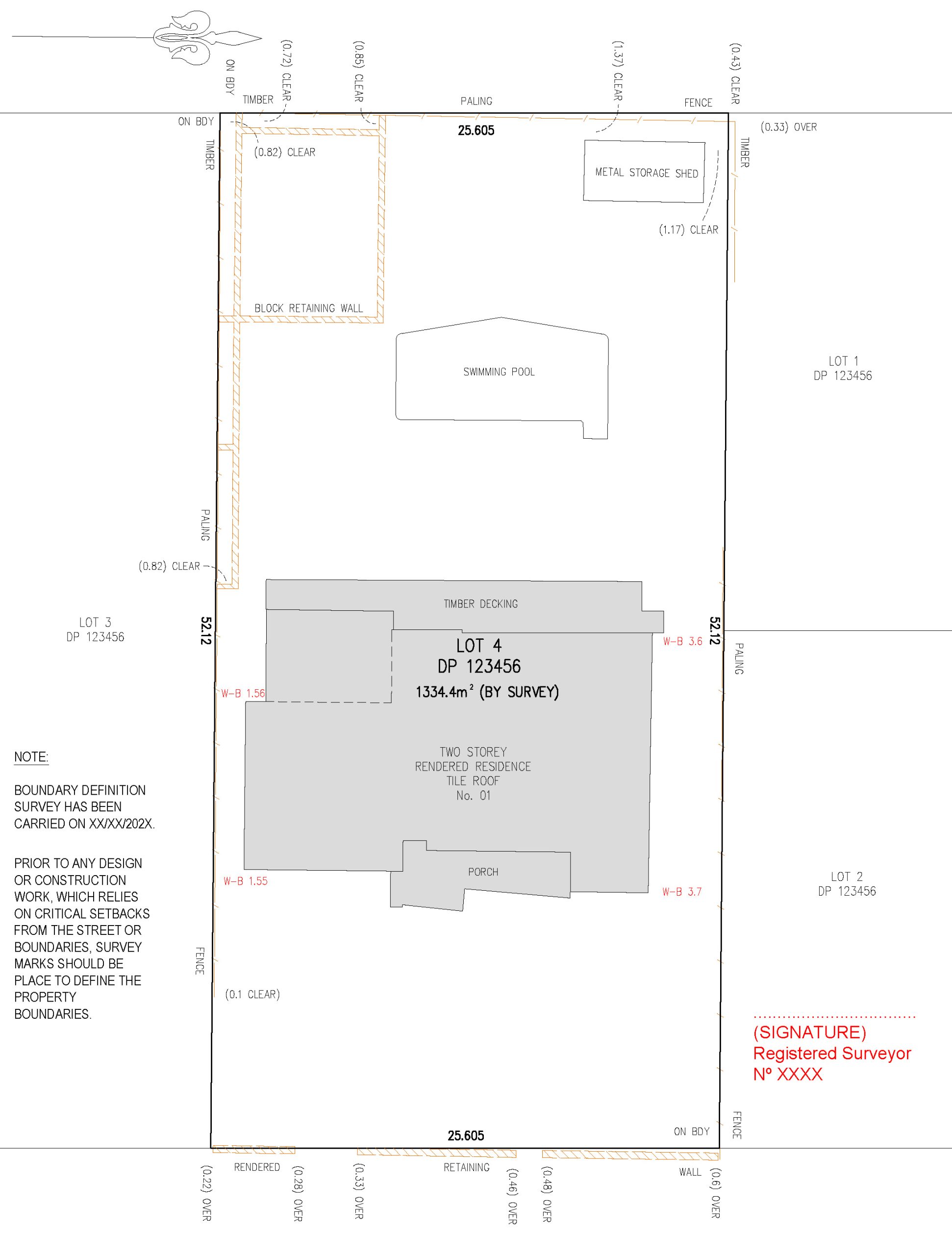
Identification survey, also called final identification survey, refers to a survey conducted during the final stages of a construction or development project to document the as-built conditions and ensure that the constructed features align with the approved design plans. This type of survey is essential for confirming that the project has been executed according to specifications and meeting relevant standards and regulations.
What’s Include:
- Establish the location of the property boundary;
- Locate new and/or existing buildings and/or extension in relation to boundary;
- Showing any visible encroachments;
- Describe type of fences and showing existing fences in relation to the boundary;
- Investigate any easements, restrictions or covenants over the land that are noted on the Title;
- Sketch showing location of building in relation to the property boundaries and signed by Registered Surveyor;
- Including building floor levels and any other physical feature levels.